Preliminary Study of the Coastal Zone
Make a preliminary Institutional Map to understand Governance in relation to Human Activities and stakeholder groups.
Action points of the implementation:
Institutional mapping consists of the identification and framing of the relationships between institutions present in the coastal zone. It identifies information and resource flow, and power relationships among the institutional stakeholders present. Major key points of these process are:
- identifying the EU and national legal framework regulating the human activities,
- identifying the national, regional and local authorities responsible for the enforcement of the legal framework and the relationships between them (exchange of information, funding, other kind of influence),
- identifying the relationships of the stakeholder groups deriving from the public sector and civil society with the aforementioned institutional stakeholders.
Area:
Himmerfjärden , Sweden.
Policy Issue:
Eutrophication status and reduction.
Human Activities:
Urban sewage discharge, agriculture and industrial activity, tourism.
General Information:
Nutrient loading has caused increased turbidity, loss of biodiversity, including submerged aquatic vegetation, deep water oxygen deficiency, phytoplankton blooms and biodiversity loss. The main stakeholder concerns are connected with tourism, recreational activities and nature enjoyment, and the sustainable implementation of WFD that poses economic challenges for several activities in the area.
Example of Implementation:
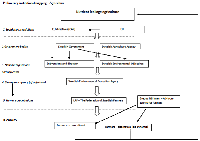
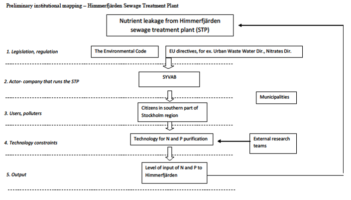
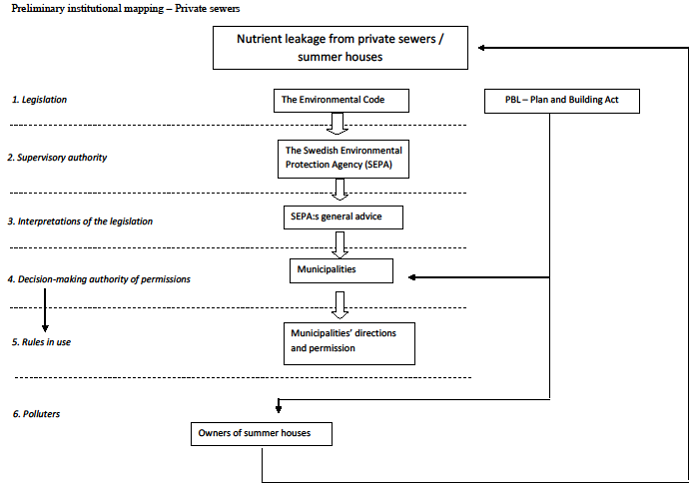
The Himmerfjärden institutional map.
Comments:
This final version of the institutional map of Himmerfjärden area was created after the selection of the policy issues from the stakeholders and thus is centralized in the three major human activities connected with the input of nutrients in the sea: agriculture, local sewage treatment plant and private sewers. Separation into tree independent entities provides a clear demonstration of the different levels of authority and interrelationships but lacks in providing a combined representation of the total institutional status and the interconnections between activities.
Contact:
Ragnar Elmgren: ragnar.elmgren@ecology.su.se